
What the postcode check is based on
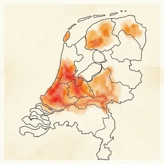
Every Dutch postcode has six characters: four digits for the area and two letters for a few streets. The check starts from our regional profile for the four-digit area, which records the typical soil and foundation history. With a full six-character postcode it adds the local soil map and the ground level, so a peat pocket inside a sandy district is picked up. The national foundation map from PDOK then shows how many buildings in the postcode were built before 1970 on soil that is sensitive to settlement.
Your answers about building period, foundation type and visible damage move the indication up or down. A pre-1940 house on timber piles in peat scores higher than the same street built after 1990. Reported cracks or sloping floors raise the indication; a foundation that has already been replaced lowers it.
What the result can and cannot tell you
The result is a preliminary foundation risk indication for the postcode, not a verdict on one house. Soil can change within a few hundred metres, and two houses in one terrace can stand on different foundations. Only archive records and a specialist foundation survey establish the actual foundation type and condition.
The four levels, low, possible, elevated and acute, describe the postcode check only. The paid report uses a separate A to E grade per address. Neither is an official F3O, KCAF, FunderMaps, NRVT or valuation label.